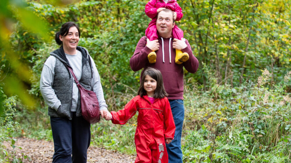
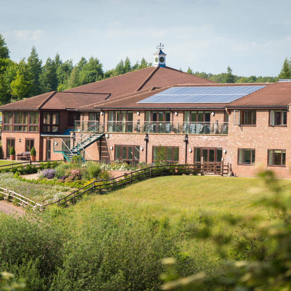
Rutland is the perfect place for walking and has long attracted ramblers who enjoy finding their way around the tiny villages, little known tracks and country lanes. One of the best features is that you’re never far away from a great village pub! Find a handy table of walks with route lengths and local pubs on ourwalking blog here.
Rutland Heritage Trails
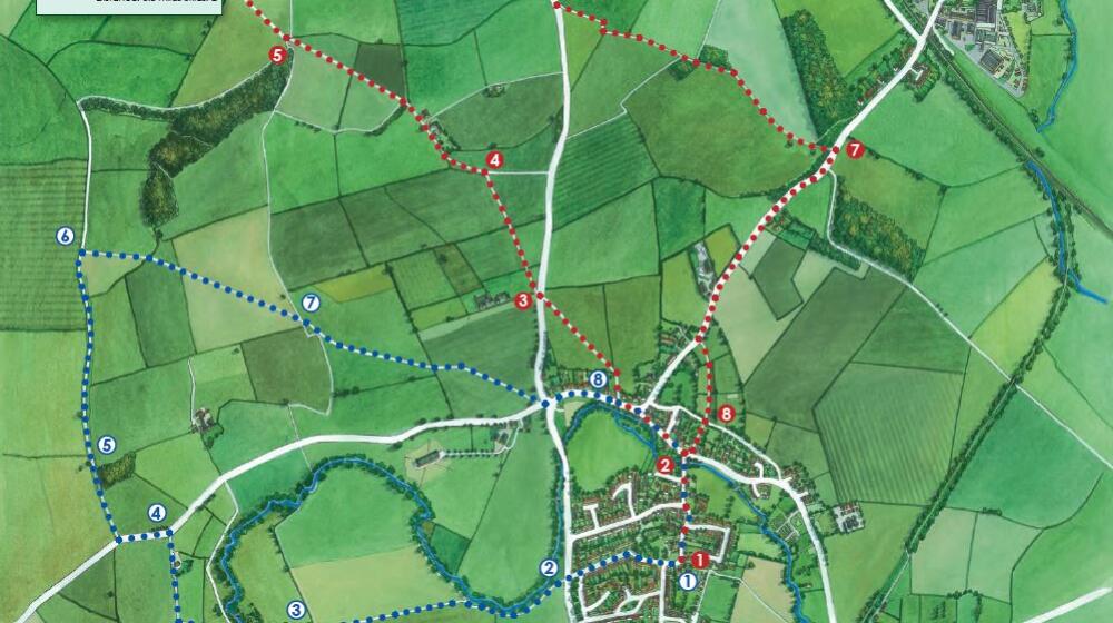
Our collection of 7 Rutland Heritage Trailsprovide both a walking and cycling route and are available online and at the visitor centres at Rutland County Museum and Sykes Lane. These are circular routes exploring our beautiful countryside, quaint villages and the occasional pub!
Bishops, Bombs & Bonfires – Lyddington and Stoke Dry
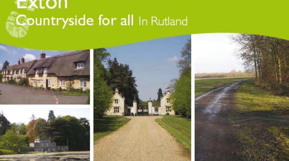
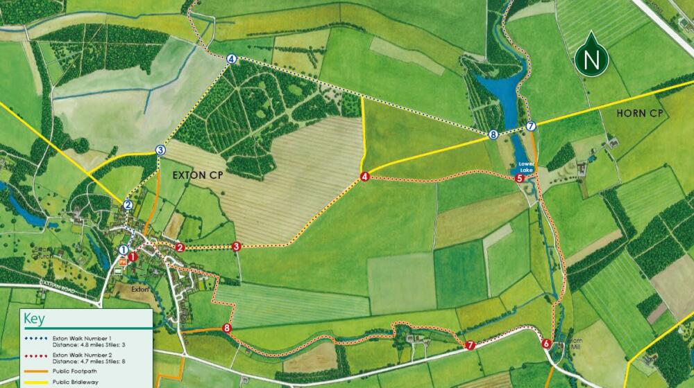
Fields & Follies – Exton
Romans, Roses & Poems – Great Casterton and Pickworth
Mills, Quarries & Railways – Pilton, North and South Luffenham
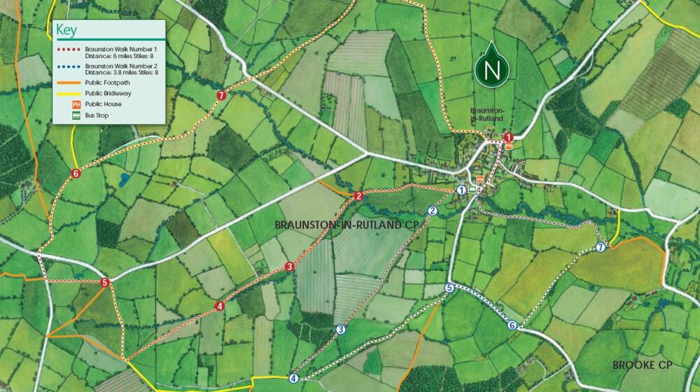
Forests, Monks & Pagans – Braunston and Brooke
Mysterious Mazes & Vanished Villages – Wing, Manton and Preston
Canals & Canterbury, Water & Westminster – Market Overton, Whissendine and Langham
Rutland Walking Leaflets
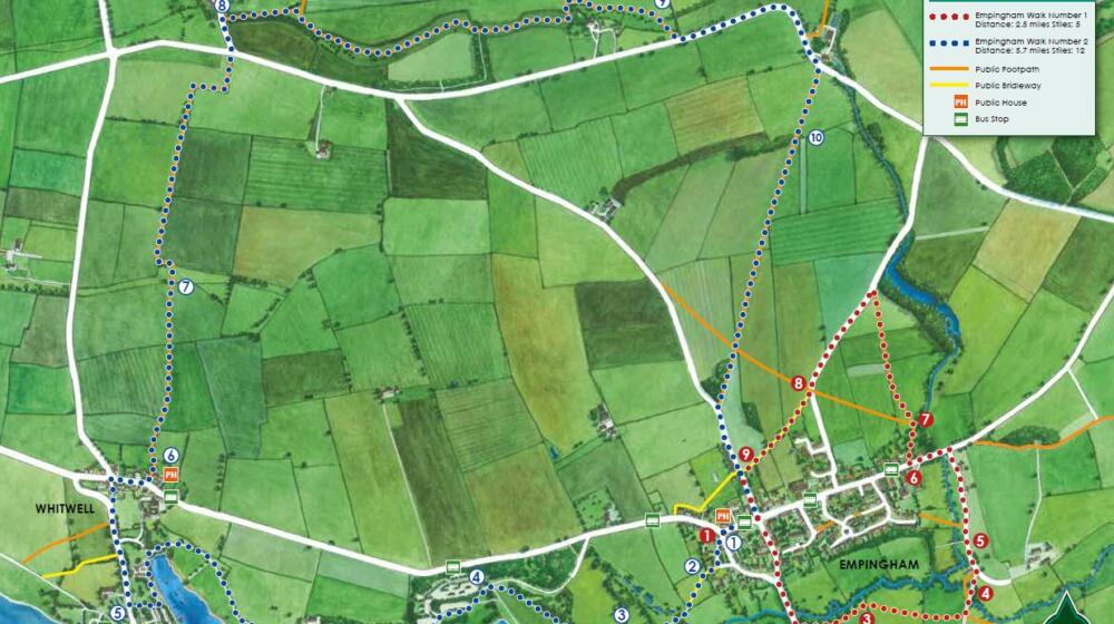
Numerous enjoyable walks have been specially put together for you by experienced and knowledgeable locals, taking in some of the most beautiful parts of the county in five of our picturesque villages, each with a fabulous local pub! Click Exton walks – Braunston walks – Empingham walks – Ryhall walks – Wing walks.
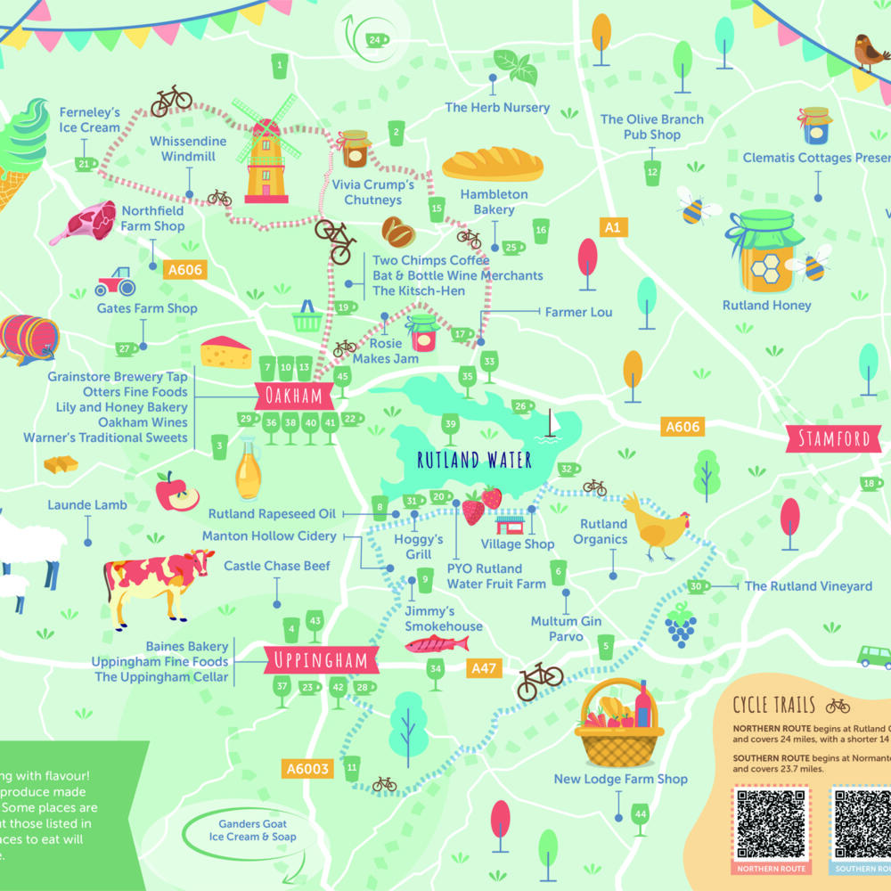
As well as the bike routes in each of the Rutland Heritage Trails about, the Discover Rutland Food & Drink Map features two suggested bike routes for road cycling;
The Northern Route begins at Rutland Garden Village and covers 24 road miles, with a shorter 14 mile option.
The Southern Route begins at Normanton Car Park and covers 23.7 road miles
Hire eBikes from a variety of Rutland businesses and let your legs take you further.
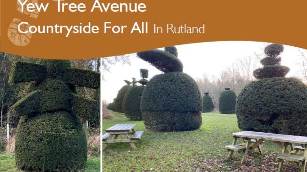
Places to go, things to see
At Rutland Water, with it’s 22.1 mile circuit (or 15.1 miles without the peninsula), you can decide how far you want to venture, then turn around and head back. The distance between the car parks are roughly;
Sykes Lane to Whitwell = 1.2 miles
Whitwell to Barnsdale = 1.5 miles
Barnsdale to Egleton = 3.4 miles
Egleton to Lyndon = 3.8 miles
Lyndon to Normanton = 2.9 miles
Normanton to Sykes Lane = 2.3 miles
Perimeter Track = 15.1 miles
Hambleton Peninsula = 7 miles
Perimeter Track + Peninsular = 22.1 miles
South of the county is the beautiful Fineshade Wood with play areas, cafe, cycling facilities and 3 walking trails to suit all;
Dales Wood trail – scenic woodland walk using purple markers. 3 miles (4.8 km)
Mill Wood trail – long woodland walk using pink markers. 6 miles (9.7 km)
The Smelters’ walk – short, circular family friendly walk using yellow markers. 2 miles (3.2 km)
The Rutland Round, is a complete tour around the perimeter of the county launched in 2000, covering a route totalling 65 miles. The route can be broken down into sections, making the undertaking less daunting, and you can do this during the Rutland Walking Festival in May. A guide to The Rutland Round can be purchased from local bookshops, such as Walkers of Oakham on the High Street.
The Uppingham Round: A circular walk of around 80 miles with Uppingham at its geographical centre, it passes through the districts of Harborough (Leicestershire), Corby (Northamptonshire) and East Northamptonshire. It takes in some less trodden routes and crosses some of the most attractive countryside as well as visiting notable parish churches and offering views of the Harringworth viaduct.
The Melton Round: a 64 mile walk which circles Melton Mowbray, taking in northerly parts of Rutland, designed to take advantage of the fine views available in the area.
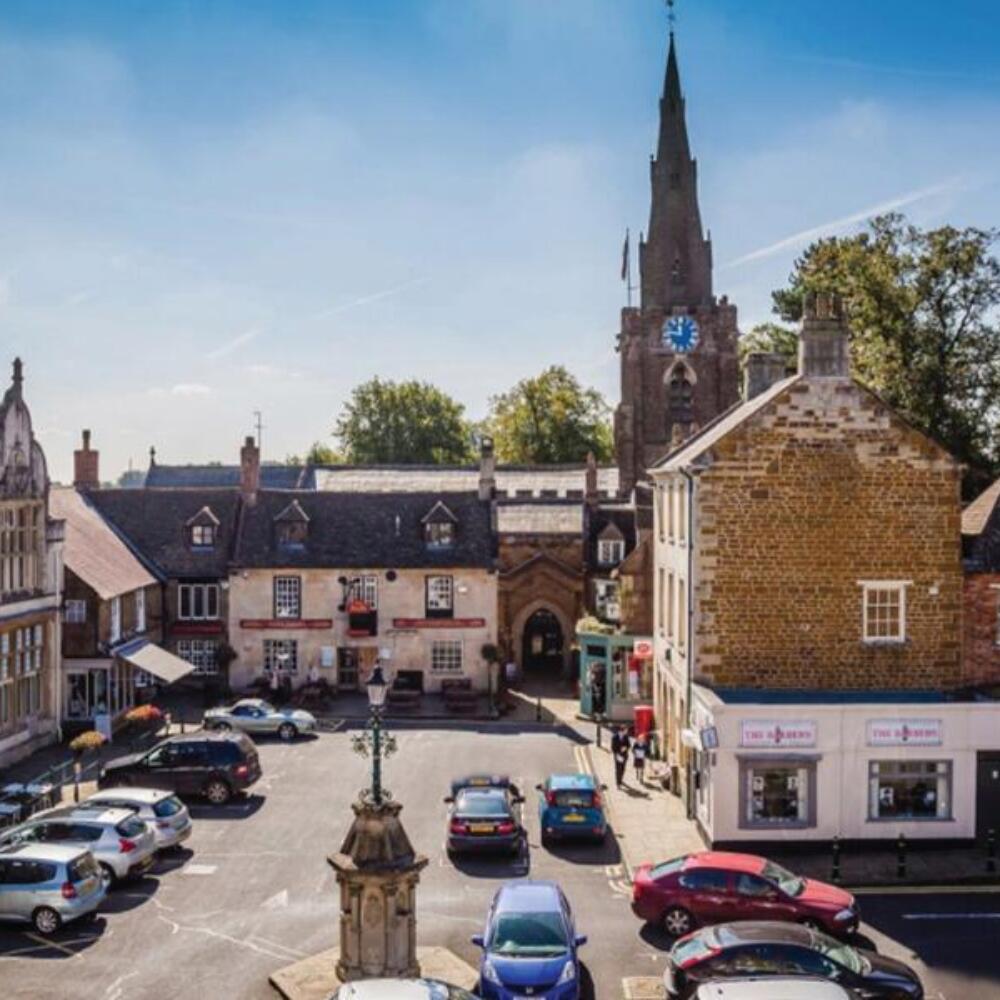
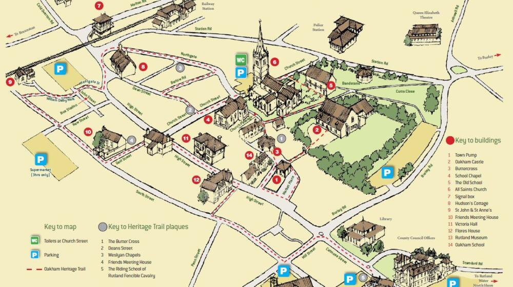
If you’d like to enjoy the character and history of our market towns and learn more about the stories of their past, with plenty of opportunities to sample the delights of nearby shops and cafes, then take a look at the Oakham Heritage Trail and Uppingham Heritage Trailfor a wonderful day out.
National Routes
There are several famous walking routes which pass through the county;
The Macmillan Way is a 290 mile route from Boston in Lincolnshire to Abbotsbury in Dorset, and was originally developed to raise money for Macmillan Cancer Support and has raised over £350,000 to date. It was opened as a fully signed and waymarked route in 1996. This route passes the south banks of Rutland Water.
The Viking Way is a 147 mile route crossing an area historically occupied by Norse invaders. Starting in Hull, winds its way southwards from the Humber Bridge, through the Lincolnshire Wolds and finishes in Oakham. The official plaque marking the end of this historic route is outside the Rutland County Library.
The Hereward Way covers 110 miles, starting in Oakham and finishing in Thetford, Norfolk.
The Jurassic Way follows the band of Jurassic Limestone that runs along the northern boundary of Northamptonshire, along the Oxford Canal, via Middleton Cheney and Woodford Halse to Braunston on the Grand Union Canal. Here it passes between Market Harborough and Corby, following the Welland Valley to Rockingham with its castle. 90 miles long.
Rutland Driving Trails
Discover the hidden gems of the East Midlands with these scenic drives that the whole family will enjoy.
If you’re looking for things to do during your visit to Rutland, take on one of our magnificent Mystery Driving Tours, starting in either Oakham or Uppingham. Each route takes in a different part of the county and provides a fascinating insight into the wealth of Rutland history that you can find in our beautiful villages and market towns. Castles, Palaces, a Royal Forest, film locations, a macabre past, medieval churches, steam engines and even reminders from the jurassic era – you’ll be surprised to find such a fusion of history, geology, architecture, science and Victorian industry all ready to tell an amazing story of the smallest county in England throughout the ages!
Several books have been published detailing interesting walks around the county for all ability levels. The Rutland Walking & Cycling Festivalhas been held towards the end of May each year for the last 10 years. It’s a superb celebration of Rutland’s glorious countryside with lots of top tips for getting the best out of cycling and walking your way around Rutland.
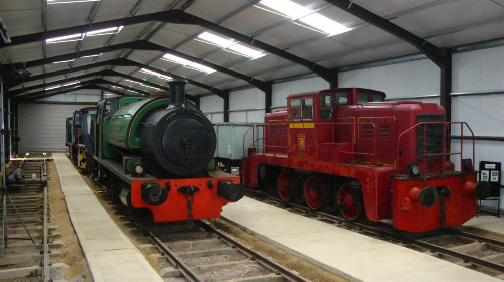
Rocks by Rail is an outdoor living museum covering 19 acres of reclaimed quarry and railway tracks to offer a journey back in time. Situated 4 miles from Oakham, explore fascinating nature trails, take a train trip, drive a classic loco and tour the workshop.
Since 2013 Ye Olde England Tours have led the way with private and personalised tours. We treat our guests like family and friends and thats often how we end up.
We have collated a table for you with information on the distance of the walk, where to find the map and even some pubs along the route to stop of for a well deserved drink!
Oakham is a unique place as it has one of the oldest continually active courts in England. There are numerous sites linked to crime and punishment and the last remaining New Drop Gallows in England, all within a short walk.
Part of the new Discover Rutland Food & Drink Map is this Northern Cycle Route of 24 miles, with a shorter 14 mile option. The route follows rural roads.
Part of the new Discover Rutland Food & Drink Map is this Southern Route of 23.7 miles. The route follows rural roads and an option to join the Rutland Water cycle paths.
If you find yourself staying in Oakham and looking for a reasonably flat walk to see the picturesque Rutland Water, then this is for you. It stays on pavements and hard footpaths so should never get muddy.
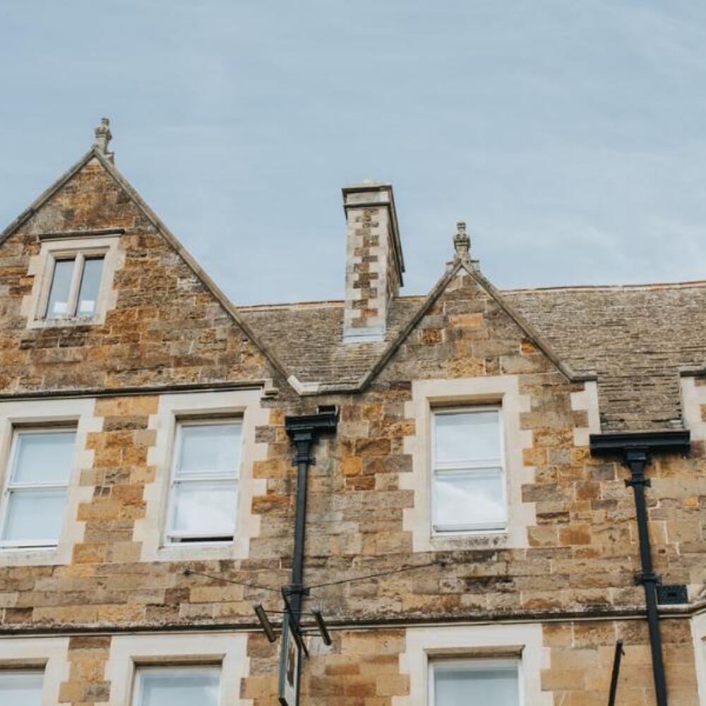
Oakham, the county town of Rutland, is a classic English market town, mentioned in the Domesday Book of 1086. It has a castle, market place, butter cross and stocks, a famous old school, all in close association with a magnificent parish church and arranged in a rectangular shape around which the town has grown.